
Hammond Neighbors by Public Record
No official source supplies a complete list of every person on a Hammond block. Instead, each record answers a narrow question. GIS shows which parcels are next to one another. The assessor links a public owner field to each parcel. Recorder instruments document transfers. City minutes identify some civic groups, while directories and maps provide older block context. These sources should be kept separate because a parcel owner may not occupy the site and an organization contact is not a membership roster.
| Source | What It Shows About a Block | Access |
|---|---|---|
| Lake County GIS parcel layer | Adjacent geometry, parcel IDs, situs and mailing fields | Public map and query service |
| XSoft DataOnly | Owner, address, property number, detail and map links | Free public portal |
| Recorder index | Ownership instruments along the block over time | Account or county counter; web cutoff unknown |
| Indiana voter records | Individual confirmation or regulated precinct products | Name lookup or State Form 48648 |
| City minutes and civic groups | Named organizations, meetings, and civic geography | Published minutes or City Clerk request |
| Directories and maps | Historical names, lots, footprints, and street numbers | Library and special collections |
A sound block lookup records what each line proves. The owner field supports an ownership lead. Matching situs and mailing addresses may suggest owner occupancy, but it does not establish the names of all people present. The parcel polygon proves geographic adjacency only. That careful language is especially important when identifying Hammond neighbors for family history, civic contact, or neighborhood research.
Hammond's Adjacent Parcel Test
The official Lake County parcel layer supports map queries, pagination, ordering, statistics, and spatial relationships. Start with one known parcel and inspect polygons that touch it. If clicking is hard, a small query envelope can return nearby candidates. The research test around the Hammond Public Library produced ten records, but an envelope can include parcels that are close without truly touching.
De-duplicate the result before drawing a block. One large parcel may border several blocks, and one parcel may carry more than one address. Keep the target parcel ID, each candidate parcel ID, situs address, mailing address, municipality or township, legal description, public owner field, and assessor link in separate columns. Adjacency never proves a relationship between people.
Read Hammond Neighbor Addresses Carefully
The county data separates situs, mailing, and legal identity. Situs is the mapped physical location. Mailing is where tax correspondence goes. The legal description identifies the land through a subdivision, lot and block, or another survey description. One street address may involve several parcels, while a single parcel may show several addresses.
- Parcel
- A mapped unit of land identified by the county, often with an ID beginning with 45 in Lake County.
- Situs address
- The physical location attached to the parcel.
- Mailing address
- The destination used for owner or tax correspondence, which can be elsewhere.
- Spatial relation
- A map test such as touches or intersects used to identify nearby polygons.
The Hammond library example illustrates the distinction without exposing a private household. Its mapped situs is 550 State St, while the mailing address appears as 564 State Street. Treating those as two neighbors would be a basic error.
Map Hammond Neighbors by Parcel
The Lake County XSoft parcel map supplies the visual path from one known address to the immediate block. Work outward only after the target polygon is centered and its parcel record is confirmed.
- Search the complete address in XSoft, open its map, and zoom until parcel boundaries are visible.
- Click every polygon that truly touches the target. Save its parcel ID and situs before looking at names.
- Open each assessor detail and compare the owner field, mailing address, legal description, class, and municipality.
- Add plat books, Sanborn sheets, street-numbering maps, and directory street sections only when older block context is needed.
This method stays within the immediate radius. For the ownership and address chain along an entire road, use the Hammond street directory instead.
Hammond Neighbors and Voter Data
The public Indiana Voters portal asks for an individual's first name, last name, date of birth, and county. It can confirm registration and election-location details for that supplied person. It has no button that reveals all voters on a Hammond block.
Broader voter products follow a different route. State Form 48648 offers vote-history, voter-registration, and walking-list choices at county, township, or precinct scope. Indiana rules distinguish some political-committee access from restricted copies and redact birth date and gender for other requesters. Address Confidentiality Program information remains protected. A precinct is election geography, not a promise of a public neighbor list.
Note: Do not create a block roster by repeating individual voter lookups; use the portal only for a known person's lawful confirmation.
Hammond Districts and Civic Groups
Hammond identifies six planning districts: Robertsdale, North Hammond, Central Hammond including Downtown, Woodmar, South Hammond, and Hessville. These names help describe city geography, but they are not association borders and do not imply membership. No current official master list of neighborhood associations, homeowners' groups, or block watches was located.
| Civic layer | Documented Hammond role | How to contact or verify |
|---|---|---|
| Pulaski Park Neighborhood Association | Monthly meetings referenced in 2022 and 2023 council minutes near the Hammond Mohawks and 141st-Calumet area | Search minutes or request records from the City Clerk |
| Hammond Hispanic Community Committee | Works with the city in the Tree Streets and northern area; monthly meetings | 824 Hoffman Street, 219-804-2108, organization page |
| United Neighbors Inc. | Name appears in EPA community-plan material | Confirm current activity before relying on the older listing |
| City community-development network | Includes a nonprofit grant network and public commissions | Current city pages and meeting records |
Meeting records establish that a group was named or active at a given time. They do not disclose private members. The Hammond City Clerk is the proper fallback for public minutes that are not online.
Tree Streets Community Contacts
The Hammond Hispanic Community Committee provides a real public contact in the Tree Streets community layer. Its history says the group was founded in 1993 and became a nonprofit in 1996. The organization works with the city, lists monthly meetings, and publishes its Hoffman Street contact information. Nothing on the page should be treated as a resident or member directory.
The captured organization page shows the public mission and contact route.

For Hammond neighbors, this community source can confirm where to ask about open meetings or local projects. It cannot confirm who lives next door. The USPS South Calumet Avenue result also provides a public checkpoint for the southern Hammond postal area.
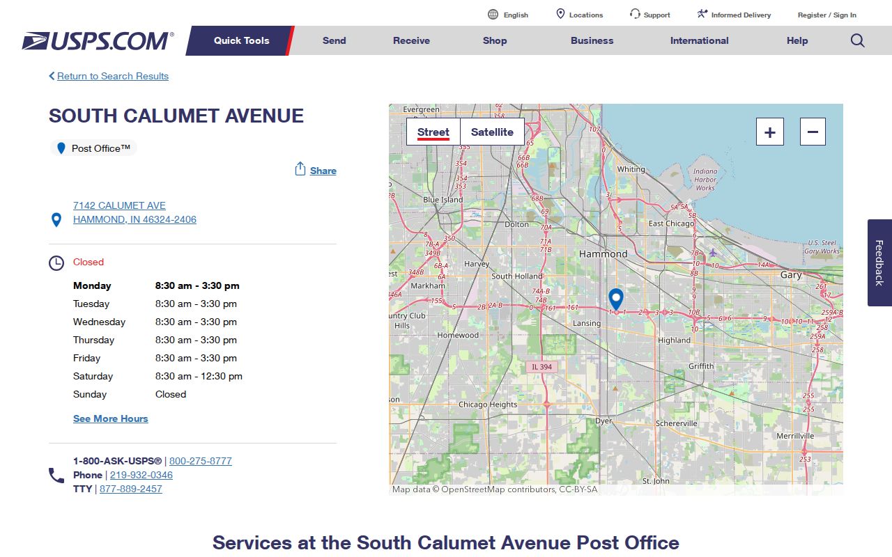
That station record confirms a postal facility and mailing ZIP, not the names of people on nearby blocks.
Official Hammond Block Sources
Commercial neighbor tools often merge parcel, directory, marketing, and old-address data. That blend can look complete while lagging behind a deed, confusing mailing and situs addresses, or omitting protected people. Official sources are narrower, but each has a known custodian and a defined record purpose.
| Source type | Strength | Limit |
|---|---|---|
| County parcel and assessor records | Current land geometry and public ownership fields | Owner is not necessarily occupant |
| Recorder and City Clerk records | Filed instruments and public meeting records | May require an account, counter visit, or records request |
| Commercial compiled tools | May collect several clues in one view | Can be stale, merged, or hard to correct |
When an official record is wrong, contact its custodian and keep proof of the error. Indiana's public-records law provides access, but it is not a general deletion system.
Privacy Limits for Hammond Neighbors
Private household members, utility and delivery accounts, DMV addresses, confidential court or vital attachments, and protected voter details do not become public because two parcels touch. Indiana's Safe at Home program supplies qualifying participants with a substitute address for government interactions. Election records can also carry a confidentiality flag that withholds identifying details except through specified legal process.
Lawful use. Hammond block records are for civic awareness, family research, and safe community contact. Never use them to watch, harass, intimidate, or harm anyone.
A parcel neighbor is a geographic fact, not a social tie. Verify current information with the county or city office that keeps it, and accept a protected or unavailable record as a hard boundary.